
New Delhi: Now ‘JalDoot’ will monitor groundwater table across the country. The data collected and fed regularly from the field can be access through mobile or web-based application, called ‘JalDoot’, has been launched by the Union ministry of rural development (MoRD) on Tuesday.
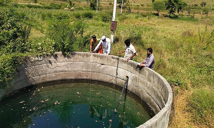
JalDoot app has been jointly developed by Union ministry of rural development and panchayati raj. This app will be used across the country to capture the water level of selected 2-3 wells in a village. Manual monitoring of water levels in open wells will be measured twice in a year, from 1st May to 31st May as pre-monsoon water level and from 1st October to 31st October for post-monsoon level for the same well.
Jaldoots, that is, officers assigned to measure the water levels, should also upload the geo-tagged photographs through the app on every occasion of measurement. This mobile app will work in both online and offline mode. So water level can be captured even without internet connectivity and captured date will be stored in mobile and when mobile comes in the connectivity area, data will synchronize with the central server.
The regular data to be input by the JalDoots would be integrated with the database of National Water Informatics Centre (NWIC), which can be utilised for analysis and display of various useful reports for the benefit of various stakeholders. Water level report, monsoon report and registered user report are available at JalDoot web portal.
Also Read: Bihar CM launches ₹3588-Cr rural solar street lighting project
While addressing the gathering at the app launch event, Union minister of state for rural development and steel Faggan Singh Kulaste said that with the newly launched app, the state government/union territories and gram panchayats should involve themselves towards systematically collecting ground water level data and assimilation of the same in the central digital database for analysis.
He said that the despite promoting watershed development, afforestation, waterbody development and renovation, rainwater harvesting like initiatives, the ground water level in various parts of the country has depleted. He said this app will facilitate in observing water tables across the country and the resulting data can be utilised for gram panchayat development plan and Mahatma Gandhi NREGA plans.
Also Read: Centre mulls plan to strengthen water testing facilities in villages
Minister of State, Sadhvi Niranjan Jyoti in her address said that the withdrawal of ground water has reached critical levels in many parts of the country and addressing this issue is a priority. Therefore measurement and observation of the levels of water tables across the country has become necessary. She said that if rain water check dams are built, they will be useful in management and conservation of rain water.
Union Minister of State for panchayati raj Kapil Moreshwar Patil said that the state governments should take measures by involving the gram panchayats towards systematically collecting ground water level data. He said we should work together on mission mode to raise the ground water level across the country.


")